 June 2011
Project: Foraging on Islands below Climate Change Lines
Methodology:
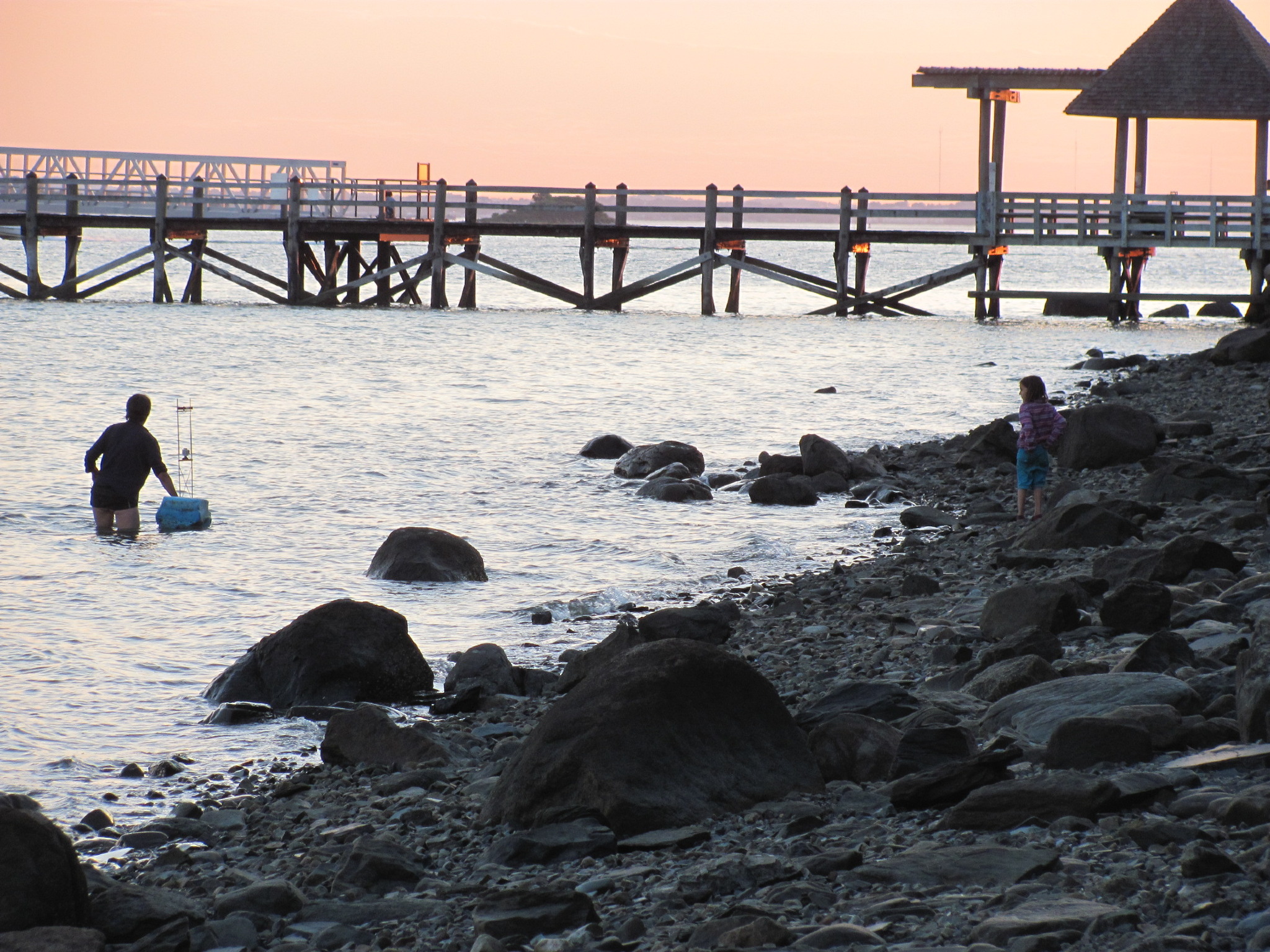
A four-day pilot project on two islands (Bumpkin and Lovells) in the Boston Harbor camping on urban islands reachable by public transportation, where a climate change initiated sea level rise will alter the morphology of the island. While camping on the islands, as many plants as feasible will be documented and foraged for seed and for use as food items for human consumption. The intention will be to provide a meal at least partially foraged from either the zone of disappearance or the zone of disturbance or both. The project looks at areas retaining biotic ecological function within a zone of urban influence., under conditions of climate change.
Definitions:
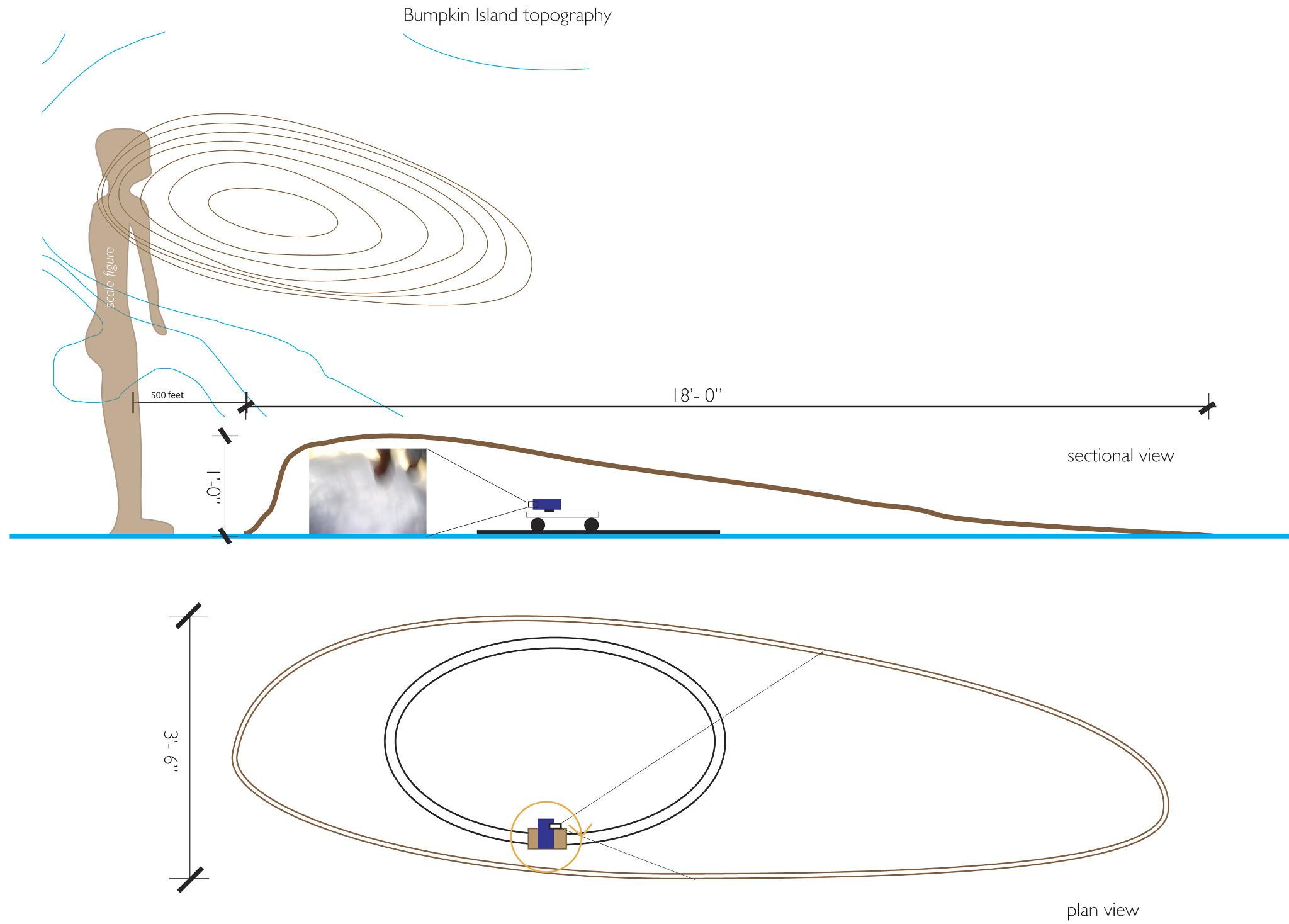
Zone of disappearance:
An area from the high tide line (“uppermost wrack line not in rooted vegetation”) (Elliman, 2005) to 80 cm above the high tide line, projected to be underwater by year 2100.
Zone of disturbance:
An area 80 cm higher in elevation from the 80 cm line datum assumed to be altered significantly by tidal and storm actions by the year 2100.
Urban islands:
This project defines urban islands as land-masses surrounded by water within sight of or affected by or constituting urban centers. The islands need be habitable, both in the sense of currently able to be lived on or at least camped on, and in the sense of having possibly attracted human habitation prior to the explosion of the Anthropocene (to borrow Bill Fox’s epochal designation of when human carbon burning shows up in the geologic record.)
Public Transportation:
This project includes only islands able to be reached by the transportation system offered by an urban municipality or other entity to or from a wild place, including boat, train, or subway. This parameter implies and perhaps enacts a relationship, both social and environmental, between the urban fabric and the biotic community.
Climate Change Line
A document to be made of the climate change line – aka the year 2100 approximately 80 cm change imagined by several academic papers, NOAA and UMASS researchers as sea level rise on the Northeastern Seaboard and in particular in Boston Harbor. Already sea level rise has gone from approximately 1 mm per year to approx 3-4 mm per year
The document will consist of a video of primarily affected areas taken with a laser level line and a mechanism, either a beach walking video mounting system, or a remote controlled boat in the water video mounting system.
Foraging
This activity engages us directly with the land and its inhabitants. We will be using documents from the National Park Service of plants commonly found and identifying those that exist within the zones of disappearance and disturbance. Including the natural human desire to find food, to find sustenance in a landscape, allows us to look not only with our intellect and eyes, but also with our stomachs, muscles, hope and fears.
References:
Elliman, Ted, Flora and Plant Communities of the Boston Harbor Islands, Northeastern Naturalist, Vol. 12, Special Issue 3, Boston Harbor Islands National Park Area, Natural Resources Overview, (2005) pp 49-75
Douglas, Ellen, M. PE, PG, PhD,The Rising Tide in Boston: Sea level rise and coastal flooding due to climate change, presentation